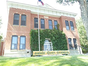
Johnson County | |
|---|---|
 | |
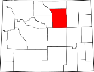
 Location within the U.S. state of Wyoming | |
 Wyoming's location within the U.S. | |
| Coordinates: 44°02′N 106°35′W / 44.04°N 106.59°W | |
| Country | |
| State | |
| Founded | December 8, 1875 (authorized) 1881 (organized) |
| Seat | Buffalo |
| Largest city | Buffalo |
| Area | |
• Total | 4,175 sq mi (10,810 km2) |
| • Land | 4,154 sq mi (10,760 km2) |
| • Water | 20 sq mi (50 km2) 0.5% |
| Population (2020) | |
• Total | 8,447 |
• Estimate (2023) | 8,759 |
| • Density | 2.0/sq mi (0.78/km2) |
| Time zone | UTC−7 (Mountain) |
| • Summer (DST) | UTC−6 (MDT) |
| Congressional district | At-large |
| Website | johnsoncountywyoming.org |
Johnson County is a county in the north central part of the U.S. state of Wyoming. At the 2020 United States Census, the population was 8,447.[1] The county seat is Buffalo.[2] Kaycee is the only other incorporated town in the county. Johnson County lies to the southeast of the Bighorn Mountains along Interstate 25 and Interstate 90. The Powder River flows northward through eastern Johnson County.
- ^ "State & County QuickFacts". US Census Bureau. Archived from the original on June 6, 2011. Retrieved January 25, 2014.
- ^ "Find a County". National Association of Counties. Archived from the original on May 31, 2011. Retrieved June 7, 2011.
