Johnsonville | |
|---|---|
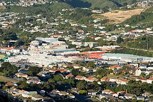
 Johnsonville shopping area | |
 | |
| Coordinates: 41°13′25″S 174°48′26″E / 41.22354°S 174.80724°E | |
| Country | New Zealand |
| City | Wellington City |
| Local authority | Wellington City Council |
| Electoral ward |
|
| Area | |
| • Land | 373 ha (922 acres) |
| Population (June 2024)[2] | |
| • Total | 12,110 |
| Postcode(s) | 6037 |
| Railway stations | Johnsonville Railway Station |
| Ohariu Valley | Churton Park | Paparangi |
| Mount Kaukau |
|
Johnsonville–Porirua Motorway, Newlands |
| Broadmeadows, Khandallah | Ngauranga Gorge |
Johnsonville is a large suburb in northern Wellington, New Zealand. It is seven kilometres north of the city centre, at the top of the Ngauranga Gorge, on the main route to Porirua (State Highway 1). It is commonly known by locals as "J'ville". Johnsonville was settled from the 1840s, became a town by 1896 and grew rapidly during the twentieth century. Johnsonville became an independent borough in 1908 and amalgamated with Wellington City in 1953.
- ^ Cite error: The named reference
Areawas invoked but never defined (see the help page). - ^ "Aotearoa Data Explorer". Statistics New Zealand. Retrieved 26 October 2024.