Josephine County | |
|---|---|
|
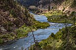
From clockwise: Josephine County Courthouse, the "It's the Climate" banner in downtown Grants Pass, Miller's Chapel in the Oregon Caves National Monument, the Rogue River from Hellgate Canyon, Illinois River Forks State Park | |
 Location within the U.S. state of Oregon | |
 Oregon's location within the U.S. | |
| Coordinates: 42°22′N 123°34′W / 42.36°N 123.56°W | |
| Country | |
| State | |
| Founded | January 22, 1856 |
| Named for | Virginia “Josephine” Rollins |
| Seat | Grants Pass |
| Largest city | Grants Pass |
| Area | |
• Total | 1,642 sq mi (4,250 km2) |
| • Land | 1,640 sq mi (4,200 km2) |
| • Water | 2.2 sq mi (6 km2) 0.1% |
| Population (2020) | |
• Total | 88,090 |
• Estimate (2023) | 87,821 |
| • Density | 50/sq mi (20/km2) |
| Time zone | UTC−8 (Pacific) |
| • Summer (DST) | UTC−7 (PDT) |
| Congressional district | 2nd |
| Website | josephinecounty |
Josephine County is one of the 36 counties in the U.S. state of Oregon. As of the 2020 census, the population was 88,090.[1] The county seat is Grants Pass.[2] The county is named after Virginia Josephine Rollins (1834–1912), a settler who was the first white woman to live in the county's boundaries. Josephine County comprises the Grants Pass, OR Metropolitan Statistical Area, which is included in the Medford-Grants Pass, OR Combined Statistical Area.
- ^ "State & County QuickFacts". United States Census Bureau. Retrieved May 15, 2023.
- ^ "Find a County". National Association of Counties. Archived from the original on May 31, 2011. Retrieved June 7, 2011.


