This article needs additional citations for verification. (June 2016) |
Juba International Airport | |||||||||||
|---|---|---|---|---|---|---|---|---|---|---|---|
 | |||||||||||
| Summary | |||||||||||
| Airport type | Public / Military | ||||||||||
| Operator | Civil Aviation Authority of South Sudan | ||||||||||
| Serves | Juba | ||||||||||
| Location | Juba, South Sudan | ||||||||||
| Elevation AMSL | 1,511 ft / 461 m | ||||||||||
| Coordinates | 4°52′19″N 31°36′4″E / 4.87194°N 31.60111°E | ||||||||||
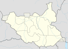
| Map | |||||||||||
 | |||||||||||
| Runways | |||||||||||
| |||||||||||
Juba International Airport (IATA: JUB, ICAO: HJJJ) is a multi-use international airport serving Juba, the capital city of South Sudan. The airport is located 5 km (3.1 mi) northeast of the city's central business district, on the western banks of the White Nile.[3] The city and airport are located in South Sudan's Central Equatoria State.
It is one of the two international airports in South Sudan, the other being Malakal Airport. Juba Airport handles international and local airlines, cargo air traffic and chartered commercial flights. It is also used by the South Sudanese military and by the United Nations UNMISS, UN Humanitarian Air Services UNHAS, World Food Program WFP, ICRC and many NGOs for relief flights for the country.
- ^ "Airport information for HSSJ". Archived from the original on 17 February 2013.
{{cite web}}: CS1 maint: unfit URL (link) from DAFIF (effective October 2006) - ^ Airport information for JUB at Great Circle Mapper. Source: DAFIF (effective October 2006).
- ^ "Juba International Airport | SKYbrary Aviation Safety". skybrary.aero. Retrieved 13 September 2022.
