Junagadh () is the city and headquarters of Junagadh district in the Indian state of Gujarat. Located at the foot of the Girnar hills, 355 kilometres (221 mi) southwest of Ahmedabad and Gandhinagar (the state capital), it is the seventh largest city in the state.
Junagadh | |
|---|---|
City | |
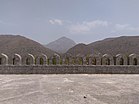
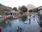
From top: Gate of the city of Junagadh, Statue of Narsinh Mehta, Girnar Hills, Radha Damodar Temple, Junagadh, Damodar Kund, Shri Swaminarayan Mandir, Junagadh, Mahabat Maqbara | |
Junagadh (Gujarat) | |
| Coordinates: 21°31′19.9″N 70°27′28.4″E / 21.522194°N 70.457889°E[1] | |
| Country | |
| State | |
| Region | Saurashtra |
| District | Junagadh |
| Established | 319 BCE |
| Government | |
| • Type | Municipal Corporation |
| • Body | Junagadh Municipal Corporation |
| • Mayor | Geetaben Parmar[1] (BJP) |
| Area | |
• Total | 160 km2 (60 sq mi) |
| • Rank | 7th |
| Elevation | 102.27 m (335.53 ft) |
| Population (2024)[2] | |
• Total | 452,000 |
| • Rank | 137 |
| • Density | 2,800/km2 (7,300/sq mi) |
| Languages | |
| • Official | |
| Time zone | UTC+5:30 (IST) |
| PIN | 36200x |
| Telephone code | +91285xxxxxxx |
| Vehicle registration | GJ-11 |
| Sex ratio | 1.04 ♂/♀ |
| Literacy rate | 88.00% |
| Website | junagadhmunicipal |
Literally translated, Junagadh means "Old Fort".[3] It was a part of Saurashtra state and later Bombay state. In 1960, in consequence of the Maha Gujarat movement, it became part of the newly formed Gujarat state.
- ^ "Junagadh Gets New Mayor, Deputy Mayor, Other Office Holders". DeshGujarat. 31 January 2022. Retrieved 2 February 2022.
- ^ "Junagadh City Population Census 2011 | Gujarat". www.census2011.co.in. Retrieved 23 October 2017.
- ^ Gopal, Madan (1990). K.S. Gautam (ed.). India through the ages. Publication Division, Ministry of Information and Broadcasting, Government of India. p. 179.


