| Juniper Dunes Wilderness | |
|---|---|
 Juniper Dunes | |
 | |
| Location | Franklin County, Washington, United States |
| Nearest city | Pasco, WA |
| Coordinates | 46°23′30″N 118°51′20″W / 46.39167°N 118.85556°W |
| Area | 7,140 acres (28.9 km²) |
| Established | 1984 |
| Governing body | United States Department of Interior Bureau of Land Management |
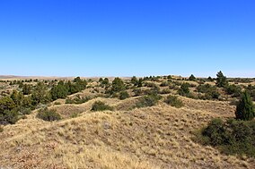
The Juniper Dunes Wilderness is a protected wilderness area comprising 7,140 acres (28.9 km²) in Franklin County, Washington. Established in 1984, it is noteworthy for the northernmost growth of western juniper trees that live among the area's large sand dunes.[1]
- ^ "Juniper Dunes Wilderness". Archived from the original on 2003-11-11. Retrieved 2008-02-21.