Kadipur
Kādīpur | |
|---|---|
Town | |
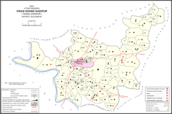
 Map showing Kadipur CD block | |
| Coordinates: 26°10′N 82°23′E / 26.17°N 82.38°E | |
| Country | |
| State | Uttar Pradesh |
| District | Sultanpur |
| Area | |
| • Total | 4 km2 (2 sq mi) |
| Elevation | 90 m (300 ft) |
| Population (2011)[2] | |
| • Total | 8,010 |
| • Density | 2,000/km2 (5,200/sq mi) |
| Language | |
| • Official | Hindi[3] |
| • Additional official | Urdu[3] |
| • Regional | Awadhi |
| Time zone | UTC+5:30 (IST) |
| PIN | 228145 |
| Vehicle registration | UP-44 |
| Blocks | Dostpur, Akhand Nagar, Kadipur, Karaundi Kala |
Kadipur is a town, tehsil and a nagar panchayat in Sultanpur district in the Indian state of Uttar Pradesh.[4] It is located a short distance from the bank of the Gomti River, at a crossroads between two roads heading from Sultanpur to Surapur and from Pratapgarh to Dostpur and then on to Akbarpur.[5] On the north side of town is a stream with a steep ravine that drains the surrounding area.[5] The road to Sultanpur crosses over this stream on a bridge.[5] The lands surrounding Kadipur are average quality for agricultural purposes.[5] As of 2011, Kadipur has a population of 8,010 people, in 1,216 households.[1]
Kadipur tehsil has 4 blocks: Akhand Nagar, Dostpur, Kadipur and Karaundi Kala. The Chairman of Kadipur is Vijay Bhan Singh.
- ^ a b "Census of India 2011: Uttar Pradesh District Census Handbook - Sultanpur, Part A (Village and Town Directory)" (PDF). Census 2011 India. pp. 521–38, 758–73. Retrieved 30 November 2021.
- ^ Cite error: The named reference
Census2011Govwas invoked but never defined (see the help page). - ^ a b "52nd Report of the Commissioner for Linguistic Minorities in India" (PDF). nclm.nic.in. Ministry of Minority Affairs. Archived from the original (PDF) on 25 May 2017. Retrieved 11 January 2019.
- ^ "Pin Code: KADIPUR, SULTANPUR, UTTAR PRADESH, India, Pincode.net.in". pincode.net.in. Retrieved 17 January 2020.
- ^ a b c d Nevill, H.R. (1903). Sultanpur: A Gazetteer, Being Volume XLVI Of The District Gazetteers Of The United Provinces Of Agra And Oudh. Allahabad: Government Press. pp. 187–9. Retrieved 30 November 2021.

