| Kaeng Krachan National Park อุทยานแห่งชาติแก่งกระจาน | |
|---|---|
 | |
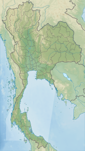
Map of Thailand | |
| Location | Phetchaburi and Prachuap Khiri Khan Provinces, Thailand |
| Nearest city | Phetchaburi |
| Coordinates | 12°47′56″N 99°27′12″E / 12.79889°N 99.45333°E |
| Area | 2,915 km2 (1,125 sq mi) |
| Established | 12 June 1981 |
| Visitors | 103,510 (in 2019) |
| Governing body | Department of National Parks, Wildlife and Plant Conservation |
| Type | Natural |
| Criteria | X |
| Designated | 2021 |
| Part of | Kaeng Krachan Forest Complex |
| Reference no. | 1461 |
| Region | Asia-Pacific |
Kaeng Krachan National Park (Thai: อุทยานแห่งชาติแก่งกระจาน, RTGS: Utthayan Haeng Chat Kaeng Krachan, pronounced [ʔùt.tʰā.jāːn hɛ̀ŋ t͡ɕʰâːt kɛ̀ŋ krā.t͡ɕāːn]) is the largest national park of Thailand.[1][2] It is on the border with Burma, contiguous with the Tanintharyi Nature Reserve. It is a popular park owing to its proximity to the tourist town of Hua Hin. It was named a UNESCO World Heritage Site on 26 July 2021,[3][4] despite concerns from the OHCHR around the human rights violations of the indigenous people that live in the park.[5]
- ^ Wongruang, Piyaporn (10 November 2018). "SPECIAL REPORT: Kaeng Krachan's main priority: tourism or wildlife protection?". The Nation. Archived from the original on 17 November 2018. Retrieved 17 November 2018.
- ^ Cite error: The named reference
TATwas invoked but never defined (see the help page). - ^ "Kaeng Krachan added to world heritage list". Bangkok Post. 26 July 2021. Archived from the original on 27 May 2022. Retrieved 26 July 2021.
- ^ "Kaeng Krachan Forest Complex". UNESCO. Archived from the original on 21 July 2020. Retrieved 27 July 2021.
- ^ "OHCHR | Thailand: UN experts warn against heritage status for Kaeng Krachan national park". www.ohchr.org. Archived from the original on 7 September 2021. Retrieved 7 September 2021.
