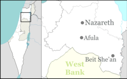
Kafr Kanna
| |
|---|---|
Local council (from 1968) | |
| Hebrew transcription(s) | |
| • ISO 259 | Kpar Kannaˀ |
| • Also spelled | Kafar Kanna (official) Kufr Kana (unofficial) |
| Coordinates: 32°45′N 35°21′E / 32.750°N 35.350°E | |
| Grid position | 182/239 PAL |
| Country | |
| District | Northern |
| Government | |
| • Head of Municipality | Izz al-Din Amara[1] |
| Area | |
| • Total | 10,600 dunams (10.6 km2 or 4.1 sq mi) |
| Population (2022)[2] | |
| • Total | 24,108 |
| • Density | 2,300/km2 (5,900/sq mi) |
| Name meaning | "Village of Cana"[3] |
Kafr Kanna (Arabic: كفر كنا, Kafr Kanā; Hebrew: כַּפְר כַּנָּא) is an Arab town in the Galilee, part of the Northern District of Israel. It is associated by Christians with the New Testament village of Cana, where Jesus turned water into wine.[4][5] In 2022 its population was 24,108.[2] It has a religiously mixed population of Muslims and Christians from different denominations.
A Jewish village during antiquity,[6] Kafr Kanna is mentioned in an extant 9th-century Islamic marble stele. Under Crusader rule, from the 12th to mid-13th centuries, it was a casale (country estate). Kafr Kanna had become a large village by 1300, during Mamluk rule. It flourished as one of the largest localities in Palestine and one of the two market towns of the Safed Sanjak under Ottoman rule in the 16th century, when its population was mostly Muslim with a significant Jewish minority. By the 19th century, its population was roughly equal parts Muslim and Christian, a state which persisted through British Mandatory rule (1917–1948). Since 1948, it is a part of Israel.
- ^ "תוצאות הבחירות המקומיות 2024 סיבוב שני". www.themarker.com (in Hebrew). 11 March 2024. Retrieved 10 May 2024.
- ^ a b "Regional Statistics". Israel Central Bureau of Statistics. Retrieved 21 March 2024.
- ^ Palmer, 1881, p. 127
- ^ Conder and Kitchener, 1881, SWP I, pp. 367, 391-394
- ^ The near-miracle in Kafr Kana
- ^ Cite error: The named reference
:0was invoked but never defined (see the help page).

