| Kali Bekasi | |
|---|---|
| Location | |
| Country | |
| Province | West Java |
| Regency | Bekasi, Bekasi Regency |
| Physical characteristics | |
| Source confluence | Cikeas and Cileungsi |
| Mouth | Jakarta Bay (Java Sea) |
• location | Babelan, Bekasi Regency |
| Basin size | 1,410 km2 (540 sq mi)[1] |
| Basin features | |
| River system | DAS Bekasi (DAS220046)[1] |
| Tributaries | |
| • left | Cikeas River |
| • right | Cileungsi River |
| KML file | Drainage basin of Bekasi |
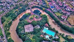
Kali Bekasi (Bekasi River) is a river that originates from a confluence of the Cikeas and Cileungsi rivers in the south of the border between the city of Bekasi and Bogor Regency. It flows northward, cutting through the city center of Bekasi towards the downstream area in Bekasi Regency, where it merges the flood control canal CBL (Cikarang-Bekasi-Laut), built during the era of President Soeharto's government in 1977 to prevent flooding in the northern coastal region of Bekasi. This canal intercepts numerous tributaries coming from the south, spanning from Cikarang to Bekasi. From the confluence point in the Babelan district, its flow is directed northwest until it meets the eastern of Jakarta Bay, part of the Java Sea.[2][3]


Kali Bekasi serves as the main stem in the Bekasi river system, covering an area of 1,410 km2 (540 sq mi).[1] The area includes parts of Bogor Regency in the upper reaches to the mid-section of the basin, parts of the city of Bekasi in the central section of the basin, and a significant portion of Bekasi Regency, extending from the central to the lower part of the basin.[4]
The Bekasi river basin is adjacent to the Citarum river basin on the eastern side, spanning from the upper to the lower reaches of the Bekasi river basin. In the upper southern region, the Bekasi river basin shares its boundary with the upper Ciliwung river basin extending to the west. It is further followed by the Sunter river basin and the Cakung river basin all the way to its lower part.[4]
- ^ a b c Hukum Online. "Keputusan Menteri Kehutanan No. SK.511/MENHUT-V/2011" (in Indonesian).
- ^ ATO, STEFANUS (2022-01-29). "Cikarang Bekasi Laut, Pengendali Banjir yang Jadi Tempat Sampah Terbesar". kompas.id (in Indonesian). Retrieved 2023-11-03.
- ^ Kadri, Trihono (2007). Erosi Pada DAS Bekasi dan Pengaruhnya Terhadap Banjir. FTSP TRISAKTI.
- ^ a b "Peta Interaktif". WebGIS MenLHK (in Indonesian). Retrieved 2023-10-09.


