Kaliganj
কালীগঞ্জ | |
|---|---|
 | |
| Coordinates: 23°24′50″N 89°8′0″E / 23.41389°N 89.13333°E | |
| Country | |
| Division | Khulna |
| District | Jhenaidah |
| Area | |
| • Total | 310.19 km2 (119.77 sq mi) |
| Population | |
| • Total | 308,504 |
| • Density | 990/km2 (2,600/sq mi) |
| Time zone | UTC+6 (BST) |
| Postal code | 7350[2] |
| Website | kaliganj |
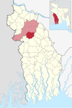
Kaliganj (Bengali: কালীগঞ্জ) is an upazila of Jhenaidah District in the Division of the Khulna, Bangladesh. One of the most important commercial area is Kaliganj under Khulna Division. It crosses between Dhaka Khulna Highway. It has the myth of Gazi Kalu Champabati, The historical mosques of Barobazar, the largest banyan tree in Asia and the flow of Chitra and Begobati. It is bounded by Jhenaidah Sadar on the north, Jessore district on the south, Kotchandpur Upazilla in the west and Magura district in the east.
- ^ National Report (PDF). Population and Housing Census 2022. Vol. 1. Dhaka: Bangladesh Bureau of Statistics. November 2023. p. 400. ISBN 978-9844752016.
- ^ "Bangladesh Postal Code". Dhaka: Bangladesh Postal Department under the Department of Posts and Telecommunications of the Ministry of Posts, Telecommunications and Information Technology of the People's Republic of Bangladesh. 21 October 2024.


