Kamrup
Kamarupa | |
|---|---|
 | |
| Coordinates: 26°15′N 91°30′E / 26.25°N 91.5°E | |
| Country | India |
| Ancient capital | Pragjyotishpura, Durjaya |
| City | Barpeta, Guwahati, Nalbari, Palashbari, Rangiya |
| Population (2011) | |
• Total | 6,000,000 |
| Time zone | UTC+5.30 (UTC+05:30 (IST)) |
| Area codes | 0361 |
| Website | www www www www |


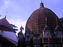
Kamrup is the modern region situated between two rivers, the Manas and the Barnadi in Western Assam, with the same territorial extent as the Colonial and post-Colonial "Undivided Kamrup district".[1][2] It was the capital region of two of the three dynasties of Kamarupa and Guwahati, the current political center of Assam, is situated here. It is characterized by its cultural artifacts.[3]
- ^ Pratap Chandra Choudhury, The history of civilisation of the people of Assam to the twelfth century , Page 448, 1959 The Kamapitha of the Tantras was no other than Kamarupa and Kamakhya.
- ^ "These theoretical divisions are not known from the early epigraphic records and may have been fabricated in the late medieval period." (Sircar 1990, p. 68)
- ^ Upendranath Goswami (1970), A Study on Kāmrūpī: A Dialect of Assamese