| Kanker State कांकेर रियासत | |||||||
|---|---|---|---|---|---|---|---|
| Vassal state of Maratha Confederacy (1758 - 1803) Princely State of British India | |||||||
| 14th century–1947 | |||||||
|
Flag | |||||||
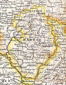
 Kanker State in the Imperial Gazetteer of India | |||||||
| Area | |||||||
• 1901 | 3,701.09 km2 (1,429.00 sq mi) | ||||||
| Population | |||||||
• 1901 | 103,536 | ||||||
| History | |||||||
• Established | 14th century | ||||||
| 1947 | |||||||
| |||||||
Kanker State (Hindi: कांकेर) was one of the princely states of India during the period of the British Raj. Its last ruler, Maharajadhiraj Bhanu Pratap Deo, signed the accession to the Indian Union in 1947.
Kanker State was located north of Bastar State and, except for the valley of the Mahanadi in its eastern part, it consisted mostly of hills covered by forests in which teak (Tectona grandis), sirsā (Dalbergia latifolia), śāl (Shorea robusta) and bījāsāl (Pterocarpus marsupium) predominated. The state had 63,610 inhabitants in 1881 and 103,536 in 1901, more than half of whom were Gonds. Kanker town in Kanker District, Chhattisgarh, was the capital of the state and the see of the Raja's residence. The languages spoken in the state were mainly Chhattisgarhi, Halbi and Gondi.[1]
