Karaka | |
|---|---|
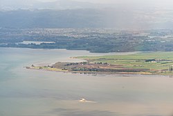
 Aerial view of northern Karaka, with Papakura and the Hunua Ranges in the background. | |
 | |
| Coordinates: 37°6′S 174°52′E / 37.100°S 174.867°E | |
| Country | New Zealand |
| Region | Auckland Region |
| Territorial authority | Auckland Council |
| Ward | Franklin ward |
| Board | Franklin Local Board |
| Electorates | |
| Area | |
• Total | 86.68 km2 (33.47 sq mi) |
| Population (June 2024)[2] | |
• Total | 3,180 |
| • Density | 37/km2 (95/sq mi) |
| Postcode | 2120 |
| Area code | 09 |
Karaka is a small rural area in the south of Auckland, New Zealand. Formerly part of Franklin District and under the authority of the Franklin District Council, it is now part of Auckland Council (under the Franklin Local Board[3]) following the amalgamation of the Auckland region's councils.
The area includes Karaka Lakes and Karaka Harbourside Estate.
- ^ Cite error: The named reference
Areawas invoked but never defined (see the help page). - ^ "Aotearoa Data Explorer". Statistics New Zealand. Retrieved 26 October 2024.
- ^ "Franklin Local Board". Retrieved 26 March 2013.