Karatay | |
|---|---|
District and municipality | |
 Mevlana Museum, Karatay | |
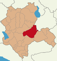
 Map showing Karatay District in Konya Province | |
| Coordinates: 37°52′05″N 32°31′44″E / 37.86806°N 32.52889°E | |
| Country | Turkey |
| Province | Konya |
| Government | |
| • Mayor | Hasan Kılca (AKP) |
| Area | 2,832 km2 (1,093 sq mi) |
| Elevation | 1,015 m (3,330 ft) |
| Population (2022)[1] | 370,927 |
| • Density | 130/km2 (340/sq mi) |
| Time zone | UTC+3 (TRT) |
| Area code | 0332 |
| Website | www |
Karatay is a municipality and district of Konya Province, Turkey.[2] Its area is 2,832 km2,[3] and its population is 370,927 (2022).[1] Karatay is one of the central districts of Konya along with the districts of Meram and Selçuklu. It covers the eastern part of the agglomeration of Konya and the adjacent countryside.
The solar power plant Kızören in Konya which went online in 2016 covers an area of 430,000 m2 and will be able to produce 26 GWh of electricity annually.[4][5]
- ^ a b "Address-based population registration system (ADNKS) results dated 31 December 2022, Favorite Reports" (XLS). TÜİK. Retrieved 19 September 2023.
- ^ Büyükşehir İlçe Belediyesi, Turkey Civil Administration Departments Inventory. Retrieved 19 September 2023.
- ^ "İl ve İlçe Yüz ölçümleri". General Directorate of Mapping. Retrieved 19 September 2023.
- ^ Company opens Turkey’s ‘largest solar power plant’ in Central Anatolia
- ^ Konya Karatay Kızören Güneş Enerji Santrali

