Karatu District
Wilaya ya Karatu (Swahili) | |
|---|---|
| Nickname(s): Home of the Hadzabe; The onion capital of Tanzania | |
 Karatu District in Arusha | |
| Coordinates: 03°20′43.44″S 35°40′10.92″E / 3.3454000°S 35.6697000°E | |
| Country | |
| Region | Arusha Region |
| District | 1997 [1] |
| Capital | Karatu Town |
| Area | |
| • Total | 3,207 km2 (1,238 sq mi) |
| • Rank | 4th in Arusha |
| Highest elevation (Marang Mountains) | 1,910 m (6,270 ft) |
| Population (2022) | |
| • Total | 280,454 |
| • Rank | 4th in Arusha |
| • Density | 87/km2 (230/sq mi) |
| Demonym | Karatuan |
| Ethnic groups | |
| • Settler | Swahili |
| • Native | Hadza, Datooga & Iraqw |
| Time zone | UTC+3 (EAT) |
| Tanzanian Postcode | 236xx |
| Website | Official website |
| Symbols of Tanzania | |
| Bird |  |
| Mammal | |
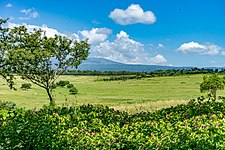
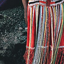
Karatu District (Wilaya ya Karatu, in Swahili) is one of seven districts of the Arusha Region of Tanzania. The district is bordered to the north by the Ngorongoro District and to the west by the Meatu District in the Simiyu Region. The district is bordered to the east by the Monduli District, and to the south and southeast by the Mbulu District and the Babati District. The district covers an area of 3,207 km2 (1,238 sq mi).[2] The district is comparable in size to the land area of Samoa.[3] The district has an max elevation of 1,739 m (5,705 ft) on Oldeani Peak.[4] Predominantly settled by Iraqw, Karatu district is home to the hunter-gatherer community of the Hadza people. Also Karatu is known agriculturally as the onion capital of Tanzania.[5] The district capital is the town of Karatu. According to the 2022 census, the population of the district was 280,454.[6][7]
- ^ "Karatu District Profile". Retrieved 2023-02-06.
- ^ "District area".
- ^ 2,831 km2 (1,093 sq mi) for Samoa at "Area size comparison". Nation master. 2022. Retrieved 23 January 2023.
- ^ "Oldean, Karatu Elevation".
- ^ "Red gold of Tanzania". Retrieved 2022-06-14.
- ^ "Tanzania: Administrative Division (Regions and Districts) - Population Statistics, Charts and Map". www.citypopulation.de. Retrieved 2024-02-10.
- ^ "2012 Population and Housing Census" (PDF). Development Partners Group Tanzania. Retrieved 7 August 2019.


