Karlskoga Municipality
Karlskoga kommun | |
|---|---|
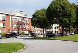
 Karlskoga Town Hall | |
 | |
| Coordinates: 59°20′N 14°31′E / 59.333°N 14.517°E | |
| Country | Sweden |
| County | Örebro County |
| Seat | Karlskoga |
| Government | |
| • Chairman of the municipal board | Tony Ring (M)[1] |
| Area | |
| • Total | 510.38 km2 (197.06 sq mi) |
| • Land | 468.23 km2 (180.78 sq mi) |
| • Water | 42.15 km2 (16.27 sq mi) |
| Area as of 1 January 2014. | |
| Population (31 December 2023)[3] | |
| • Total | 30,261 |
| • Density | 59/km2 (150/sq mi) |
| Time zone | UTC+1 (CET) |
| • Summer (DST) | UTC+2 (CEST) |
| ISO 3166 code | SE |
| Province | Värmland and Närke |
| Municipal code | 1883 |
| Website | www.karlskoga.se |
| Density is calculated using land area only. | |
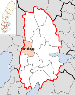
Karlskoga Municipality (Karlskoga kommun) is a municipality in Örebro County in central Sweden. Its seat is located in the city of Karlskoga. Other localities include Valåsen och Labbsand, Kortfors, Linnebäck and Villingsberg.
Karlskoga was formed as rural municipality when the first Swedish local government acts came into force in 1863. In 1925 the southern part was detached, forming Degerfors Municipality. In 1940 the whole municipality, including its non-urban areas, got the title of a city. These titles were abolished in 1971.
- ^ ""Nu ska jag träffa så många näringslivsrepresentanter som möjligt"". Svenskt Näringsliv (in Swedish). Retrieved 2021-08-08.
- ^ "Statistiska centralbyrån, Kommunarealer den 1 januari 2014" (in Swedish). Statistics Sweden. 2014-01-01. Archived from the original (Microsoft Excel) on 2016-09-27. Retrieved 2014-04-18.
- ^ "Folkmängd och befolkningsförändringar - Kvartal 4, 2023" (in Swedish). Statistics Sweden. February 22, 2024. Retrieved February 22, 2024.
