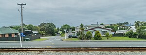
Karoro | |
|---|---|
 Warburton Street | |
 | |
| Country | New Zealand |
| City | Greymouth |
| Local authority | Grey District Council |
| Electoral ward | Central |
| Area | |
| • Land | 649 ha (1,604 acres) |
| Population (June 2024)[2] | |
• Total | 1,120 |
| Blaketown | Greymouth centre | |
| (Tasman Sea) |
|
|
| Paroa | Boddytown |
Karoro is a suburb to the south-west of Greymouth on the West Coast of New Zealand.[3][4]
- ^ Cite error: The named reference
Areawas invoked but never defined (see the help page). - ^ "Aotearoa Data Explorer". Statistics New Zealand. Retrieved 26 October 2024.
- ^ Peter Dowling, ed. (2004). Reed New Zealand Atlas. Reed Books. pp. map 69. ISBN 0-7900-0952-8.
- ^ Roger Smith, GeographX (2005). The Geographic Atlas of New Zealand. Robbie Burton. pp. map 156. ISBN 1-877333-20-4.