You can help expand this article with text translated from the corresponding article in Georgian. (September 2015) Click [show] for important translation instructions.
|
Kaspi
კასპი | |
|---|---|
Town | |
 panorama of Kaspi | |
| Coordinates: 41°55′30″N 44°25′20″E / 41.92500°N 44.42222°E | |
| Country | |
| Region | Shida Kartli |
| District | Kaspi |
| Town from | 1959 |
| Highest elevation | 700 m (2,300 ft) |
| Lowest elevation | 560 m (1,840 ft) |
| Population (January 1, 2024)[1] | |
| • Total | 12,415 |
| Time zone | UTC+4 (Georgian Time) |
| Area code | +995 371 |
| Website | http://www.kaspi.org.ge |
 | |
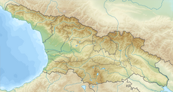
Kaspi (Georgian: კასპი) is a town in central Georgia on the Mtkvari River. It is a center of Kaspi district, one of the four districts in Shida Kartli region. Founded in the early Middle Ages, the town turned into possession of the Amilakhvari noble family in the 15th century. Kaspi officially acquired a town's status in 1959 and, as of January 2023[update], had the population of 12,708.[2]
The Kaspi cement plant is one of Georgia's largest industrial facilities and sources of air pollution.
During the Russia-Georgia war, the cement factory, as well as the railway bridge in the city were severely damaged by the Russian raids.
- ^ "Population by regions". National Statistics Office of Georgia. Retrieved 28 April 2024.
- ^ "Population - National Statistics Office of Georgia". www.geostat.ge. Retrieved 2023-06-28.

