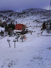
Kato Vermio
Κάτω Βέρμιο Selia de Jos, Selia | |
|---|---|
 Seli ski resort | |
| Coordinates: 40°33′N 22°1.6′E / 40.550°N 22.0267°E | |
| Country | Greece |
| Administrative region | Central Macedonia |
| Regional unit | Imathia |
| Municipality | Veria |
| Municipal unit | Veria |
| Area | |
| • Community | 38.915 km2 (15.025 sq mi) |
| Elevation | 1,400 m (4,600 ft) |
| Population (2021)[1] | |
| • Community | 268 |
| • Density | 6.9/km2 (18/sq mi) |
| Time zone | UTC+2 (EET) |
| • Summer (DST) | UTC+3 (EEST) |
| Postal code | 591 00 |
| Area code(s) | +30-2331 |
| Vehicle registration | ΗΧ |
Kato Vermio (Greek: Κάτω Βέρμιο, before 1926: Κάτω Σέλι - Kato Seli,[2] Aromanian: Selia de Jos[3] or just Selia[4]) is, primarily, an Aromanian (Vlach) Greek village and a community of the Veria municipality.[5] Since the 2001 local government reform it is part of the municipality of Veria, of which is a municipal district.[5] The 2021 census recorded 268 residents in the village.[1] The altitude of the village is 1400-1550 meters, making it, probably, the highest populated village in Greece. There are about 1250 households in the village. The community of Kato Vermio-Seli covers an area of 38.915 km2.[6]
- ^ a b "Αποτελέσματα Απογραφής Πληθυσμού - Κατοικιών 2021, Μόνιμος Πληθυσμός κατά οικισμό" [Results of the 2021 Population - Housing Census, Permanent population by settlement] (in Greek). Hellenic Statistical Authority. 29 March 2024.
- ^ Name changes of settlements in Greece
- ^ de Puig, Lluís Maria (17 January 1997). "Document 7728 (1997) on the Aromanians". Committee on Culture, Science and Education.
- ^ Nicea, Cola (2001). "Memorii" (PDF). Scara – revistă de oceanografie ortodoxă (in Romanian) (7): 1–32.
- ^ a b "ΦΕΚ B 1292/2010, Kallikratis reform municipalities" (in Greek). Government Gazette.
- ^ "Population & housing census 2001 (incl. area and average elevation)" (PDF) (in Greek). National Statistical Service of Greece. Archived from the original (PDF) on 2015-09-21.
