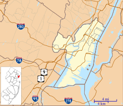
Kearny, New Jersey | |
|---|---|
 Kearny Library and Museum, November 2011 | |
 Interactive map of Kearny | |
| Coordinates: 40°45′08″N 74°07′23″W / 40.752332°N 74.123093°W[1][2] | |
| Country | |
| State | |
| County | |
| Incorporated | April 8, 1867 |
| Named for | Philip Kearny |
| Government | |
| • Type | Town |
| • Body | Town Council |
| • Mayor | Carol Jean Doyle (I, serving expired term ending December 31, 2025)[3][4] |
| • Administrator | Stephen Marks[5] |
| • Municipal clerk | Pat Carpenter[6] |
| Area | |
• Total | 10.27 sq mi (26.61 km2) |
| • Land | 8.84 sq mi (22.91 km2) |
| • Water | 1.43 sq mi (3.70 km2) 13.91% |
| • Rank | 209th of 565 in state 3rd of 12 in county[1] |
| Elevation | 7 ft (2 m) |
| Population | |
• Total | 41,999 |
| 39,370 | |
| • Rank | 54th of 565 in state 7th of 12 in county[13] |
| • Density | 4,748.9/sq mi (1,833.6/km2) |
| • Rank | 122nd of 565 in state 11th of 12 in county[13] |
| Time zone | UTC−05:00 (Eastern (EST)) |
| • Summer (DST) | UTC−04:00 (Eastern (EDT)) |
| ZIP Codes | |
| Area code(s) | 201 and 973[16] |
| FIPS code | 3401736510[1][17][18] |
| GNIS feature ID | 0885266[1][19] |
| Website | www |
Kearny (/ˈkɑːrni/ KAR-nee[20][21]) is a town in the western part of Hudson County, in the U.S. state of New Jersey, and a suburb of Newark. As of the 2020 United States census, the town's population was 41,999,[10][11] an increase of 1,315 (+3.2%) from the 2010 census count of 40,684,[22][23] which in turn reflected an increase of 171 (+0.4%) from the 40,513 counted in the 2000 census.[24]
Kearny is named after Civil War general Philip Kearny.[25][26] It began as a township formed by an act of the New Jersey Legislature on April 8, 1867, from portions of Harrison Township. Portions of the township were taken on July 3, 1895, to form East Newark. Kearny was incorporated as a town on January 19, 1899, based on the results of a referendum held two days earlier.[27] The Arlington section of town was named for Arlington Station on the Erie Railroad at the Arlington Mill plant, owned by Arlington Mills of Lawrence, Massachusetts.
- ^ a b c d 2019 Census Gazetteer Files: New Jersey Places, United States Census Bureau. Accessed July 1, 2020.
- ^ US Gazetteer files: 2010, 2000, and 1990, United States Census Bureau. Accessed September 4, 2014.
- ^ Cite error: The named reference
Mayorwas invoked but never defined (see the help page). - ^ 2023 New Jersey Mayors Directory, New Jersey Department of Community Affairs. Accessed February 1, 2023.
- ^ Town Administrator, Town of Kearny. Accessed February 7, 2024.
- ^ Town Clerk, Town of Kearny. Accessed February 7, 2024.
- ^ Cite error: The named reference
DataBookwas invoked but never defined (see the help page). - ^ "ArcGIS REST Services Directory". United States Census Bureau. Retrieved October 11, 2022.
- ^ "Town of Kearny". Geographic Names Information System. United States Geological Survey, United States Department of the Interior. Retrieved March 6, 2013.
- ^ a b c Cite error: The named reference
Census2020was invoked but never defined (see the help page). - ^ a b Cite error: The named reference
LWD2020was invoked but never defined (see the help page). - ^ Cite error: The named reference
PopEstwas invoked but never defined (see the help page). - ^ a b Population Density by County and Municipality: New Jersey, 2020 and 2021, New Jersey Department of Labor and Workforce Development. Accessed March 1, 2023.
- ^ Look Up a ZIP Code for Kearny, NJ, United States Postal Service. Accessed October 27, 2011.
- ^ Zip Codes, State of New Jersey. Accessed December 12, 2013.
- ^ Area Code Lookup – NPA NXX for Kearny, NJ, Area-Codes.com. Accessed August 29, 2013.
- ^ U.S. Census website, United States Census Bureau. Accessed September 4, 2014.
- ^ Geographic Codes Lookup for New Jersey, Missouri Census Data Center. Accessed April 1, 2022.
- ^ US Board on Geographic Names, United States Geological Survey. Accessed September 4, 2014.
- ^ Cite error: The named reference
SoccerTownwas invoked but never defined (see the help page). - ^ Wright, E. Assata. "Secaucus: How do you pronounce it? Development put town on map, but newcomers don't know where they are", The Hudson Reporter, July 6, 2011. Accessed November 30, 2022. "Therefore, the new neighbors may proudly totter about telling folks they live in Sih-KAW-cus or See-KAW-cus. However, natives prefer that the accent be on the first syllable, as in: SEE-kaw-cus.... Bayonne is bay-OWN, not ba-YON, locals say. Kearny is Kar-nee, not Keer-nee."
- ^ Cite error: The named reference
Census2010was invoked but never defined (see the help page). - ^ Cite error: The named reference
LWD2010was invoked but never defined (see the help page). - ^ Table 7. Population for the Counties and Municipalities in New Jersey: 1990, 2000 and 2010, New Jersey Department of Labor and Workforce Development, February 2011. Accessed May 1, 2023.
- ^ Hutchinson, Viola L. The Origin of New Jersey Place Names, New Jersey Public Library Commission, May 1945. Accessed September 2, 2015.
- ^ Gannett, Henry. The Origin of Certain Place Names in the United States, p. 172. United States Government Printing Office, 1905. Accessed September 2, 2015.
- ^ Snyder, John P. The Story of New Jersey's Civil Boundaries: 1606–1968, Bureau of Geology and Topography; Trenton, New Jersey; 1969. p. 147. Accessed May 29, 2024.


