You can help expand this article with text translated from the corresponding article in Finnish. (June 2023) Click [show] for important translation instructions.
|
Keminmaa
Kiemâeennâm Ǩeeʹmmjânnam | |
|---|---|
Municipality | |
| Keminmaan kunta Keminmaa kommun | |
 | |
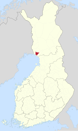
 Location of Keminmaa in Finland | |
| Coordinates: 65°48′N 024°33′E / 65.800°N 24.550°E | |
| Country | |
| Region | Lapland |
| Sub-region | Kemi–Tornio |
| Government | |
| • Municipal manager | Hannele Matinlassi |
| Area (2018-01-01)[1] | |
• Total | 647.24 km2 (249.90 sq mi) |
| • Land | 627.27 km2 (242.19 sq mi) |
| • Water | 20.73 km2 (8.00 sq mi) |
| • Rank | 137th largest in Finland |
| Population (2024-10-31)[2] | |
• Total | 7,638 |
| • Rank | 124th largest in Finland |
| • Density | 12.18/km2 (31.5/sq mi) |
| Population by native language | |
| • Finnish | 98.7% (official) |
| • Swedish | 0.1% |
| • Others | 1.2% |
| Population by age | |
| • 0 to 14 | 16.7% |
| • 15 to 64 | 57.4% |
| • 65 or older | 25.9% |
| Time zone | UTC+02:00 (EET) |
| • Summer (DST) | UTC+03:00 (EEST) |
| Website | www |
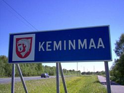
Keminmaa (Finnish: [ˈkeminˌmɑː]; until 1979 Kemin maalaiskunta; Inari Sami: Kiemâeennâm; Skolt Sami: Ǩeeʹmmjânnam) is a municipality of Finland. It is located near the towns of Kemi and Tornio in the Lapland region.
The municipality has a population of 7,638 (31 October 2024)[2] and covers an area of 647.24 square kilometres (249.90 sq mi) of which 20.73 km2 (8.00 sq mi) is water.[1] The population density is 12.18 inhabitants per square kilometre (31.5/sq mi).
- ^ a b "Area of Finnish Municipalities 1.1.2018" (PDF). National Land Survey of Finland. Retrieved 30 January 2018.
- ^ a b c "Finland's preliminary population figure was 5,635,560 at the end of October 2024". Population structure. Statistics Finland. 19 November 2024. ISSN 1797-5395. Retrieved 22 November 2024.
- ^ "Population according to age (1-year) and sex by area and the regional division of each statistical reference year, 2003–2020". StatFin. Statistics Finland. Retrieved 2 May 2021.
- ^ a b "Luettelo kuntien ja seurakuntien tuloveroprosenteista vuonna 2023". Tax Administration of Finland. 14 November 2022. Retrieved 7 May 2023.
