| Kenai River | |
|---|---|
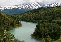
 The Kenai River at Cooper Landing, July 2008 | |
 | |
| Location | |
| Country | United States |
| State | Alaska |
| Physical characteristics | |
| Source | Kenai Lake |
| Mouth | Cook Inlet |
• location | Kenai |
• coordinates | 60°32′38″N 151°16′43″W / 60.54389°N 151.27861°W[2] |
• elevation | 0 m (0 ft) |
| Length | 82 mi (132 km) |
| Basin size | 2,010 sq mi (5,200 km2)[1] |
| Discharge | |
| • location | mouth[1] |
| • average | 5,922 cu ft/s (167.7 m3/s)[1] |
| Basin features | |
| Tributaries | |
| • left | Russian River, Killey River, Funny River |
| • right | Moose River |
The Kenai River called Kahtnu in the Dena'ina language, is the longest river in the Kenai Peninsula of southcentral Alaska. It runs 82 miles (132 km) westward from Kenai Lake in the Kenai Mountains, through the Kenai National Wildlife Refuge and Skilak Lake to its outlet into the Cook Inlet of the Pacific Ocean near Kenai and Soldotna.
- ^ a b c Benke, Arthur C.; Cushing, Colbert E. (2009). Field Guide to Rivers of North America. Academic Press. pp. 326–327. ISBN 978-0-12-378577-0. Retrieved 5 August 2013.
- ^ Cite error: The named reference
gniswas invoked but never defined (see the help page).