Kennedy Meadows (CDP) | |
|---|---|
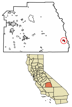
 Location of Kennedy Meadows in Tulare County, California. | |
| Coordinates: 36°00′28″N 118°06′36″W / 36.00778°N 118.11000°W | |
| Country | |
| State | |
| County | Tulare |
| Area | |
| • Total | 5.823 sq mi (15.081 km2) |
| • Land | 5.823 sq mi (15.081 km2) |
| • Water | 0 sq mi (0 km2) 0% |
| Elevation | 6,214 ft (1,894 m) |
| Population (2020) | |
| • Total | 58[1] |
| Time zone | UTC-8 (Pacific (PST)) |
| • Summer (DST) | UTC-7 (PDT) |
| GNIS feature ID | 2585427 |
| U.S. Geological Survey Geographic Names Information System: Kennedy Meadows (CDP), California | |
Kennedy Meadows refers to a census-designated place (CDP) in Tulare County, California, United States part of the Springville-Johnsondale CCD, and consists of the community surrounding Kennedy Meadows.[3] The CDP is located to the south-east of the Kennedy Meadows Campground. The 2020 United States census reported Kennedy Meadows's population of permanent residents at 58, up from 28 at the 2010 census.[3] The census definition of the area may not precisely correspond to local understanding of the area with the same name.
The Kennedy Meadows area is at approximately 6200 feet elevation. The most common access route is by the steep Sherman Pass Road from U.S. Route 395 near Pearsonville. Other routes are possible but much slower.
Kennedy Meadows sits on the Pacific Crest Trail, 703 miles (1,131 km) from the trail's southern terminus. The Pacific Crest Trail Data Book uses Kennedy Meadows as the dividing point between the dry Southern California section and the high passes of the Sierra Nevada.[4]
- ^ "Explore Census Data".
- ^ U.S. Census Archived 2012-07-02 at the Wayback Machine
- ^ a b c U.S. Geological Survey Geographic Names Information System: Kennedy Meadows (CDP), California
- ^ Go, Benedict. (2013). Pacific Crest Trail data book : mileages, landmarks, facilities, resupply data, and essential trail information for the entire Pacific Crest Trail, from Mexico to Canada (5th ed.). Birmingham, AL: Wilderness Press. ISBN 978-0-89997-745-4. OCLC 823831364.

