| Kenogami River | |
|---|---|
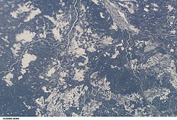
 Kenogami River from the International Space Station (diagonally at upper left corner) | |
| Etymology | "long water" in the Cree language |
| Location | |
| Country | Canada |
| Province | Ontario |
| Region | Northern Ontario |
| Districts | |
| Physical characteristics | |
| Source | Long Lake |
| • location | Longlac, Town of Greenstone, Thunder Bay District |
| • elevation | 311 m (1,020 ft) |
| Mouth | Albany River |
• coordinates | 51°06′22″N 84°28′54″W / 51.10611°N 84.48167°W |
• elevation | 75 m (246 ft) |
| Length | 320 km (200 mi) |
| Basin features | |
| River system | James Bay drainage basin |
| Tributaries | |
| • left | Little Current River, Drowning River, Little Drowning River, Kingfisher River, Ash River, Little Ash River, Nemasa River, Watistiguam River, Mundino River, Atikasibi River, Kawakanika River, Burrows River, Kenogamisis River |
| • right | Wakashi River, Kabinakagami River, Nagagami River, Pagwachuan River, Flint River, Wabigano River, Fernow River |
The Kenogami River is a river in the James Bay drainage basin in Thunder Bay and Cochrane districts in Northern Ontario, Canada,[1] which flows north from Long Lake near Longlac to empty into the Albany River.[2] The river is 320 kilometres (199 mi) in length and its name means "long water" in the Cree language. A portion of the river's headwaters have been diverted into the Lake Superior drainage basin.
- ^ "Kenogami River". Geographical Names Data Base. Natural Resources Canada. Retrieved 2011-08-18.
- ^ "Kenogami River". Atlas of Canada. Natural Resources Canada. 2010-02-04. Retrieved 2011-08-18. Shows the river course.
