| Kenosha Pass | |
|---|---|
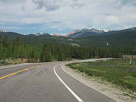
 Looking north toward the Front Range after the pass. | |
| Elevation | 9,576 ft (2,919 m)[1] |
| Traversed by | |
| Location | Park County, Colorado, U.S. |
| Range | Front Range, Kenosha Mountains |
| Coordinates | 39°24′48″N 105°45′24″W / 39.41333°N 105.75667°W |
| Topo map | USGS Jefferson |
Kenosha Pass, elevation 10,000 ft (3,000 m), is a high mountain pass located in the Rocky Mountains of central Colorado in the United States.

The pass is located in the Rocky Mountains southwest of Denver, Colorado, just northeast of the town of Fairplay, Colorado. Geologically, the pass is located atop a large granite batholith (known as the Kenosha Batholith) that forms the spine of the Front Range along the eastern side of South Park. It is traversed by US 285 between Jefferson and Grant, and provides a route between the valley of the North Fork South Platte River and the headwaters of the South Platte River in South Park. In addition to providing one of the principal access routes to South Park, the pass offers dramatic views of the surrounding Rockies, including the nearby peaks of Mount Blue Sky and Mount Bierstadt.