Kern County | |
|---|---|
|
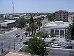
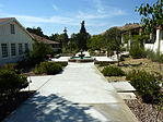
Images, from top down, left to right: Downtown Bakersfield, Cesar E. Chavez National Monument, Fort Tejon barracks, an F-35 landing at Edwards Air Force Base, the Midway-Sunset Oil Field | |
 Interactive map of Kern County | |
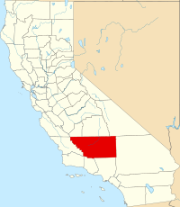
 Location in the state of California | |
| Coordinates: 35°20′N 118°43′W / 35.34°N 118.72°W | |
| Country | United States |
| State | California |
| Incorporated | April 2, 1866 |
| Named for | Kern River and Edward Kern |
| County seat | Bakersfield |
| Largest city | Bakersfield (population) California City (area) |
| Incorporated cities | 11 |
| Government | |
| • Type | Council–Administration |
| • Body | Board of Supervisors [1][2][3][4] |
| • Chair | Jeff Flores (N.P.) |
| • Vice Chair | Vacant |
| • Board of Supervisors[5] | |
| • Chief Administrative Officer[6] | Ryan J. Alsop |
| Area | |
• Total | 8,163 sq mi (21,140 km2) |
| • Land | 8,132 sq mi (21,060 km2) |
| • Water | 31 sq mi (80 km2) |
| Highest elevation | 8,755 ft (2,669 m) |
| Lowest elevation | 206 ft (63 m) |
| Population | |
• Total | 909,235 |
| • Density | 110/sq mi (43/km2) |
| GDP | |
| • Total | $57.541 billion (2022) |
| Time zone | UTC−8 (Pacific Time Zone) |
| • Summer (DST) | UTC−7 (Pacific Daylight Time) |
| Area code | 661, 760 |
| FIPS code | 06-029 |
| GNIS feature ID | 2054176 |
| Congressional districts | 20th, 22nd, 23rd |
| Website | kerncounty.com |
Kern County is a county located in the U.S. state of California. As of the 2020 census, the population was 909,235.[8] Its county seat is Bakersfield.[10]
Kern County comprises the Bakersfield, California, Metropolitan statistical area. The county spans the southern end of the Central Valley. Covering 8,161.42 square miles (21,138.0 km2), it ranges west to the southern slope of the Coast Ranges, and east beyond the southern slope of the eastern Sierra Nevada into the Mojave Desert, at the city of Ridgecrest. Its northernmost city is Delano, and its southern reach extends to just beyond Frazier Park, and the northern extremity of the parallel Antelope Valley.
The county's economy is heavily linked to agriculture and to petroleum extraction. There is also a strong aviation, space, and military presence, such as Edwards Air Force Base, the China Lake Naval Air Weapons Station, and the Mojave Air and Space Port.
With a population that is 54.9% Hispanic as of 2020, Kern is California's third-most populous majority-Hispanic county and the sixth-largest nationwide.[11]
- ^ "Phillip Peters, Supervisor, District 1 from Kern County, California".
- ^ "Mike Maggard, Supervisor, District 3 from Kern County, California".
- ^ "David Couch, Supervisor, District 4 from Kern County, California".
- ^ "Leticia Perez, Supervisor, District 5 from Kern County, California".
- ^ "Board of Supervisors | Kern County, CA".
- ^ "County Administrative Office | Kern County, CA".
- ^ a b Physical Features of Kern County Archived April 19, 2010, at the Wayback Machine. County of Kern. Retrieved July 22, 2010.
- ^ a b "QuickFacts Kern county, California". United States Census Bureau. Retrieved February 13, 2022.
- ^ "Gross Domestic Product: All Industries in Kern County, CA". Federal Reserve Economic Data. Federal Reserve Bank of St. Louis.
- ^ "Find a County". National Association of Counties. Archived from the original on May 31, 2011. Retrieved June 7, 2011.
- ^ "P2: HISPANIC OR LATINO, AND NOT HISPANIC OR LATINO BY RACE". 2020 Census. United States Census Bureau. Retrieved October 10, 2021.


