Kewaunee County | |
|---|---|
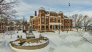
 Kewaunee County Courthouse | |
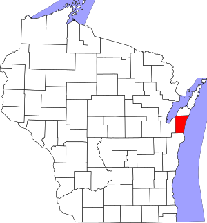
 Location within the U.S. state of Wisconsin | |
 Wisconsin's location within the U.S. | |
| Coordinates: 44°35′N 87°26′W / 44.59°N 87.44°W | |
| Country | |
| State | |
| Founded | 1859 |
| Seat | Kewaunee |
| Largest city | Algoma |
| Area | |
| • Total | 1,084 sq mi (2,810 km2) |
| • Land | 343 sq mi (890 km2) |
| • Water | 742 sq mi (1,920 km2) 68% |
| Population | |
| • Total | 20,563 |
| • Estimate (2023) | 20,690 |
| • Density | 60.0/sq mi (23.2/km2) |
| Time zone | UTC−6 (Central) |
| • Summer (DST) | UTC−5 (CDT) |
| Congressional district | 8th |
| Website | www |
Kewaunee County is a county located in the U.S. state of Wisconsin. As of the 2020 census, the population was 20,563.[2] Its county seat is Kewaunee.[3] The county was created in 1852 and organized in 1859.[4] Its Menominee name is Kewāneh, an archaic name for a species of duck.[5] Kewaunee County is part of the Green Bay, WI Metropolitan Statistical Area as well as the Green Bay-Shawano, WI Combined Statistical Area.
- ^ Cite error: The named reference
2020-census-55061was invoked but never defined (see the help page). - ^ "State & County QuickFacts". United States Census Bureau. Archived from the original on June 6, 2011. Retrieved January 21, 2014.
- ^ "Find a County". National Association of Counties. Archived from the original on May 31, 2011. Retrieved June 7, 2011.
- ^ "Wisconsin: Individual County Chronologies". Wisconsin Atlas of Historical County Boundaries. The Newberry Library. 2007. Archived from the original on April 14, 2017. Retrieved August 14, 2015.
- ^ Hoffman, Mike. "Menominee Place Names in Wisconsin". The Menominee Clans Story. Retrieved October 5, 2018.