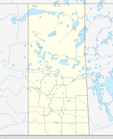
| Location | |
|---|---|
| Location | Athabasca Basin |
| Province | Saskatchewan |
| Country | Canada |
| Coordinates | 57°12′24″N 105°39′33″W / 57.20667°N 105.65917°W |
| Production | |
| Products | Uranium |
| Production | 0 |
| Financial year | 2019 |
| History | |
| Discovered | 1975 (Gaertner) 1976 (Dielmann) |
| Opened | 1983 |
| Active | 1983–1987 (Gaertner) 1989–1997 (Dielmann) 1999–2018 (milling McArthur River ore) |
| Closed | 2018 (mill) |
| Owner | |
| Company | Cameco (83.33%) Orano Canada (16.67%) |
The Key Lake mine is a former uranium mine in Saskatchewan, Canada. It is 570 kilometres (350 mi) north of Saskatoon by air on the southern rim of the uranium-rich Athabasca Basin. Key Lake was initially developed to open-pit mine two nearby uranium ore deposits: the Gaertner deposit and the Deilmann deposit. Mining of this ore ceased in the late 1990s; the Key Lake mill now processes uranium ore from the McArthur River mine and from existing stockpiles on site. High-grade ore from McArthur river is blended with lower grade local rock before being passed through the mill. The mill has a permitted annual production capacity of 25 million pounds of U3O8.[1] In addition, ammonium sulfate fertilizer is produced as a byproduct from used reagents. The pits of the mined out local deposits are being used as mill tailings management facilities.[2]
Its deposits jointly remain one of the higher grade large uranium deposits discovered, with an average grade of over 2% U3O8. Key Lake was the third largest uranium deposit in the Athabasca Basin and is surpassed only by McArthur River and Cigar Lake.
Uranium exploration was carried out by a joint venture led by Uranerz Exploration and Mining, a subsidiary of German Uranerzbergbau GmbH. Uranium anomalies in lake water detected in 1969 were followed up in 1971 with the location of radioactive pitchblende boulders in transported overburden, which were eventually followed back to their source, resulting in the discovery of the Gaertner orebody of the Key Lake deposits in 1975.[3]
The nearest village by road is Pinehouse, 220 kilometres south of Key Lake. The mine is considered the official northern terminus of Saskatchewan Highway 914, as reflected by provincial highway maps, although online mapping such as Google Maps suggest the highway continues on to another mine, McArthur River, further to the north.
In late 2017, citing "continued low uranium prices," Cameco announced that the McArthur River/Key Lake operation would suspend production for approximately ten months starting by the end of January 2018.[4] In July 2018 Cameco announced that this shut-down would extend for an indefinite period of time pending an upswing in the uranium market.[1]
- ^ a b "2017 Annual Report" (PDF). Saskatoon: Cameco Corporation. 9 February 2018. Retrieved 29 May 2020.
- ^ "Regulatory Oversight Report for Uranium Mines and Mills in Canada: 2016". Canadian Nuclear Safety Commission. 9 October 2018. Retrieved 29 May 2020.
- ^ Sibbald, T.I.I; Quirt, D.H.; Gracie, A.J., eds. (1991). "Uranium Deposits of the Athabasca Basin, Saskatchewan". Geological Survey of Canada Open File. 2166. Natural Resources Canada: 7. Retrieved 29 May 2020.
- ^ "Cameco to suspend McArthur River and Key Lake". World Nuclear News. 9 November 2017. Retrieved 16 March 2018.
