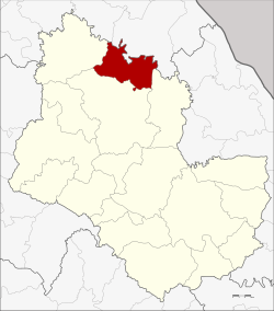
Kham Ta Kla
คำตากล้า | |
|---|---|
 District location in Sakon Nakhon province | |
| Coordinates: 17°50′58″N 103°45′18″E / 17.84944°N 103.75500°E | |
| Country | |
| Province | Sakon Nakhon |
| Seat | Kham Ta Kla |
| Area | |
• Total | 402.0 km2 (155.2 sq mi) |
| Population (2005) | |
• Total | 37,902 |
| • Density | 94.3/km2 (244/sq mi) |
| Time zone | UTC+7 (ICT) |
| Postal code | 47250 |
| Geocode | 4709 |
Kham Ta Kla (Thai: คำตากล้า, pronounced [kʰām tāː klâː]) is a district (amphoe) in the northern part of Sakon Nakhon province, northeast Thailand.