This article is written like a travel guide. (April 2020) |
Khammouane province
ແຂວງ ຄໍາມ່ວນ | |
|---|---|
 | |
 Map of Khammouane province | |
 Location of Khammouane province in Laos | |
| Coordinates: 17°30′00″N 105°20′00″E / 17.5°N 105.333333°E | |
| Country | Laos |
| Capital | Thakhek |
| Area | |
• Total | 16,315 km2 (6,299 sq mi) |
| Population (2020 Census) | |
• Total | 433,570 |
| • Density | 27/km2 (69/sq mi) |
| Time zone | UTC+7 (ICT) |
| ISO 3166 code | LA-KH |
| HDI (2017) | medium 10th |
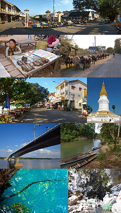
Khammouane province (Khammouan) (Lao: ຄໍາມ່ວນ, pronounced [kʰám mūan]) is a province in the center of Laos. Its capital lies at Thakhek.
Khammouane province covers an area of 16,315 square kilometres (6,299 sq mi) and is mostly of forested mountainous terrain. Many streams flow through the province to join the Mekong River. The vast forests of the Nakai-Nam Theun National Park are an important watershed that feed many Mekong tributaries as well as form the catchment area for Nam Theun 2, the largest hydropower project in Laos. The Xe Bang Fai River, Nam Hinboun River, and the Nam Theun are the main rivers of the province.
Part of the aborted Thakhek-Tan Ap railway would have crossed the province to connect with the North-South Railway at Tân Ấp Railway Station, Quảng Bình province, Vietnam through Mụ Giạ Pass.
- ^ "Sub-national HDI - Area Database - Global Data Lab". hdi.globaldatalab.org. Retrieved 2018-09-13.[not specific enough to verify]