This article needs additional citations for verification. (July 2019) |
Khao Lak
เขาหลัก (Thai) | |
|---|---|
 Khao Lak–Lam Ru National Park | |
| Coordinates: 8°41′20″N 98°15′00″E / 8.68889°N 98.25000°E | |
| Location | Takua Pa and Thai Mueang, Phang Nga, Thailand |
| Offshore water bodies | Andaman Sea |
| Etymology | Main Mountain |
| Native name | เขาหลัก (Thai) |
| Dimensions | |
| • Length | 20 kilometres (12 mi) |
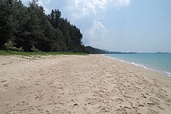
Khao Lak (Thai: เขาหลัก, pronounced [kʰǎw làk]) is a small village in Phang Nga province, located South of the main mountain. Tour operators like to use the popular name as location for a series of other villages, now tourist-oriented, mainly in the Takua Pa District of Phang Nga Province, Thailand.
The name "Khao Lak" literally translated means 'Main Mountain'. This was one of the peaks used by ancient sea farers as a landmark to guide them into the safe harbor at Thaplamu. Lak mountain is one of the main peaks in the hilly small mountainous region (maximum height 1,050 meters (3,440 ft) in Khao Lak-Lam Ru National Park.
The tiny village of Ban Khao Lak, the original beach, Hat Khao Lak, and the bay of Khao Lak (Ao Khao Lak) actually all lie in the Lam Kaen sub-district of Thai Mueang District. However the name Khao Lak has now grown to enclose many other villages in the area, mostly on the Northern side of the mountain in the Khukkhak sub-district of Takuapa district.
