| Khaptad National Park | |
|---|---|
| Location | Nepal |
| Coordinates | 29°16′12″N 80°59′24″E / 29.27000°N 80.99000°E |
| Area | 225 km2 (87 sq mi) |
| Established | 1984 |
| Governing body | Department of National Parks and Wildlife Conservation |
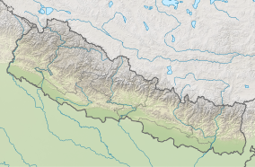
Khaptad National Park is a protected area in the Far-Western Region, Nepal that was established in 1984. Stretching over the four districts of Bajhang, Bajura, Achham and Doti it covers an area of 225 km2 (87 sq mi) and ranges in elevation from 1,400 m (4,600 ft) to 3,300 m (10,800 ft).[1][2]
- ^ Bhuju, U. R.; Shakya, P. R.; Basnet, T. B.; Shrestha, S. (2007). Nepal Biodiversity Resource Book. Protected Areas, Ramsar Sites, and World Heritage Sites (PDF). Kathmandu: International Centre for Integrated Mountain Development, Ministry of Environment, Science and Technology, in cooperation with United Nations Environment Programme, Regional Office for Asia and the Pacific. ISBN 978-92-9115-033-5. Archived from the original (PDF) on 2011-07-26. Retrieved 2018-12-14.
- ^ GoN/MoFSC (2014). Nepal Biodiversity Strategy and Action Plan 2014-2020. Government of Nepal, Ministry of Forests and Soil Conservation, Kathmandu, Nepal
