Khlung
ขลุง | |
|---|---|
 Waterfall, Namtok Phlio National Park | |
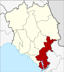
 District location in Chanthaburi province | |
| Coordinates: 12°27′17″N 102°13′17″E / 12.45472°N 102.22139°E | |
| Country | Thailand |
| Province | Chanthaburi |
| Seat | Khlung |
| Area | |
• Total | 756.038 km2 (291.908 sq mi) |
| Population (2005) | |
• Total | 55,044 |
| • Density | 72.8/km2 (189/sq mi) |
| Time zone | UTC+7 (ICT) |
| Postal code | 22110 |
| Geocode | 2202 |
Khlung (Thai: ขลุง, pronounced [kʰlǔŋ]) is the southernmost district (amphoe) of Chanthaburi province, eastern Thailand.