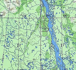
| Khoruongka Хоруонгка / Хоруоҥка | |
|---|---|
 Course of the Khoruongka | |
Mouth location in Yakutia, Russia | |
| Location | |
| Country | Russia |
| Physical characteristics | |
| Source | |
| • location | Central Yakutian Lowland |
| • coordinates | 66°14′11″N 121°41′55″E / 66.23639°N 121.69861°E |
| • elevation | ca 169 m (554 ft) |
| Mouth | Lena |
• coordinates | 67°13′59″N 123°10′36″E / 67.23306°N 123.17667°E |
| Length | 377 km (234 mi)[1] |
| Basin size | 8,330 square kilometres (3,220 sq mi)[1] |
| Basin features | |
| Progression | Lena→ Laptev Sea |
The Khoruongka (Russian: Хоруонгка, Yakut: Хоруоҥка, Xoruoŋka) is a river in the Sakha Republic (Yakutia), Russia. It is a left tributary of the Lena. Its length is 377 kilometres (234 mi) and the area of its basin is 8,330 square kilometres (3,220 sq mi).[1] The Khoruongka flows across Zhigansky District, not far to the west of Zhigansk town.[2]
The basin of the Khoruongka falls fully within the Central Yakutian Lowland and parts of it are a protected area.[3] The banks of the river are uninhabited.[2]
- ^ a b c "Река Хоруонгка in the State Water Register of Russia". textual.ru (in Russian).
- ^ a b Google Earth
- ^ Линдэ - ООПТ России
