This article needs additional citations for verification. (November 2022) |
Kichi Zībī Mīkan | |||||||
|---|---|---|---|---|---|---|---|
| English: Great River Road French: route de la grande rivière | |||||||
| Formerly: Sir John A. Macdonald Parkway Ottawa River Parkway | |||||||
Kichi Zībī Mīkan highlighted in red | |||||||
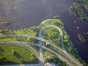
 Interchange with Parkdale Avenue | |||||||
| Route information | |||||||
| Maintained by National Capital Commission | |||||||
| Length | 9.4 km (5.8 mi) | ||||||
| Major junctions | |||||||
| West end | Carling Avenue | ||||||
| East end | Booth Street | ||||||
| Location | |||||||
| Country | Canada | ||||||
| Province | Ontario | ||||||
| Major cities | Ottawa | ||||||
| Highway system | |||||||
|
| |||||||
| |||||||
The Kichi Zībī Mīkan,[1] (/ˈkɪtʃiː ziːbiː ˈmiːkʌn/ ki-chee zee-bee MEE-kun)[2] formerly the Sir John A. Macdonald Parkway, and previously the Ottawa River Parkway, is a four-lane scenic parkway along the Ottawa River in Ottawa, Ontario, Canada. It runs from Carling Avenue near Connaught Avenue, to Booth Street at the Canadian War Museum and National Holocaust Monument. It is maintained by the National Capital Commission. The speed limit is 60 km/h (37 mph). Bicycles are allowed on the road and on a parallel recreational path along the parkway.
Besides being a scenic route, it serves as a commuter artery for westend residents who work in the downtown area, particularly government employees who work at the Tunney's Pasture office complex, and other areas. It is also used by the transit systems of Ottawa and Gatineau for express buses.
- ^ "Ottawa's Sir John A. Macdonald Parkway renamed Kichi Zībī Mīkan". cbc.ca. CBC News. June 22, 2023. Retrieved June 23, 2023.
- ^ "Renaming process: Kichi Zībī Mīkan". National Capital Commission. Retrieved 30 June 2023.
