Kilbirnie | |
|---|---|
 | |
 | |
| Coordinates: 41°19′13″S 174°47′39″E / 41.3204°S 174.7941°E | |
| Country | New Zealand |
| City | Wellington City |
| Local authority | Wellington City Council |
| Electoral ward |
|
| Area | |
| • Land | 145 ha (358 acres) |
| Population (June 2024)[2] | |
• Total | 5,030 |
| Hataitai | Evans Bay | Rongotai |
| Melrose |
|
Rongotai |
| Lyall Bay | Lyall Bay | Rongotai |
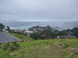
Kilbirnie (from Scottish Gaelic: Cille Bhraonaidh) is a suburb of Wellington in New Zealand, 3 kilometres (1.9 mi) to the south-east of the city centre. Travellers can reach Kilbirnie from the Wellington central business district via the Mount Victoria Tunnel and Hataitai, or over Mount Victoria, or around the coast.
Kilbirnie sits on the eastern flank of the ridge which becomes Mount Victoria and on the flat of the Rongotai isthmus between Evans Bay to the north (part of Port Nicholson) and Lyall Bay to the south (on Cook Strait). No clear boundaries separate Kilbirnie from its neighbouring suburbs, with the exception of the town belt to the west which separates Kilbirnie from Newtown.
- ^ Cite error: The named reference
Areawas invoked but never defined (see the help page). - ^ "Aotearoa Data Explorer". Statistics New Zealand. Retrieved 26 October 2024.