This article needs additional citations for verification. (May 2021) |
Kilmacrennan
Cill Mhic Réanáin | |
|---|---|
Village | |
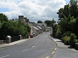
 The village is on the N56 road | |
| Coordinates: 55°01′47″N 7°46′43″W / 55.029744°N 7.778664°W | |
| Country | Ireland |
| Province | Ulster |
| County | County Donegal |
| Government | |
| • Dáil Éireann | Donegal |
| Population | 888 |
| Time zone | UTC+0 (WET) |
| • Summer (DST) | UTC-1 (IST (WEST)) |
| Irish Grid Reference | C166178 |

Kilmacrennan[2] (Irish: Cill Mhic nÉanáin or Cill Mhic Réanáin),[3] also Kilmacrenan, is a village, townland and civil parish in County Donegal, Ireland. The village population was 888, as of the 2022 census.[1] The village's population has increased steadily over the last decade[when?] with many new housing developments catering, in particular, for an overspill population from Letterkenny.[citation needed] Kilmacrennan was historically the caput of its eponymous Barony of Kilmacrennan, of the eight Baronies of Donegal.
The Battle of Kilmacrennan was fought near the village in 1608 during O'Doherty's Rebellion.
- ^ a b "Census Interactive Map – Towns: Kilmacrennan". Census 2022. Central Statistics Office. Retrieved 13 November 2024.
- ^ Official spelling used by, among others, Kilmacrennan School, Raphoe Diocese's Parish of Kilmacrennan Archived 2013-10-29 at the Wayback Machine, Kilmacrennan Celtic Football Club.
- ^ "Cill Mhic Réanáin/Kilmacrenan". Placenames Database of Ireland (logainm.ie). Retrieved 3 May 2022.
