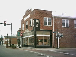
Kilmarnock, Virginia | |
|---|---|
 Street corner in downtown Kilmarnock | |
 Location of Kilmarnock, Virginia | |
| Coordinates: 37°42′45″N 76°22′54″W / 37.71250°N 76.38167°W | |
| Country | United States |
| State | Virginia |
| Counties | Lancaster, Northumberland |
| Area | |
| • Total | 3.42 sq mi (8.86 km2) |
| • Land | 3.41 sq mi (8.83 km2) |
| • Water | 0.01 sq mi (0.03 km2) |
| Elevation | 89 ft (27 m) |
| Population (2020) | |
| • Total | 1,445 |
| • Density | 409.04/sq mi (157.94/km2) |
| Time zone | UTC-5 (Eastern (EST)) |
| • Summer (DST) | UTC-4 (EDT) |
| ZIP code | 22482 |
| Area code | 804 |
| FIPS code | 51-42424 |
| GNIS feature ID | 1495790 |
| Website | kilmarnockva |
Kilmarnock is a town in Lancaster and Northumberland counties in the U.S. Commonwealth of Virginia. The population was 1,445 at the 2020 census. It is located near the mouth of the Rappahannock River and is located within the Northern Neck George Washington Birthplace American Viticultural Area winemaking appellation. There is a small hospital in the town. Lancaster Middle School, grades 4–8, is also located in town. Approximately 500 students attend the school.
The town was named after Kilmarnock, in Scotland.[2]
- ^ "2019 U.S. Gazetteer Files". United States Census Bureau. Retrieved August 7, 2020.
- ^ Gannett, Henry (1905). The Origin of Certain Place Names in the United States. Govt. Print. Off. pp. 175.