| King's Meadow | |
|---|---|
 King's Meadow and new apartments | |
| Type | Public |
| Location | Reading, Berkshire, UK |
| Coordinates | 51°27′36″N 0°57′40″W / 51.46°N 0.961°W |
| Area | 12 acres (4.9 ha) |
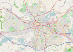
King's Meadow is a park in Reading, Berkshire, England, located next to the River Thames. It stretches from the Coal Woodland (so-called because it used to be the site of a coal heap [1]) to King's Meadow Road near Reading Bridge. The Thames Path long distance footpath runs through the length of King's Meadow, which is visible from the railway when entering or leaving Reading railway station from the eastern side.[2]
King's Meadow forms part of a series of riverside open spaces, managed by Reading Borough Council, that stretch along one or other side of the River Thames throughout its passage through Reading. From west to east these are Thameside Promenade, Caversham Court, Christchurch Meadows, Hills Meadow, View Island and King's Meadow.[3]
- ^ "Kings Meadow and the Coal Woodland". Reading Borough Council. Archived from the original on 19 August 2010. Retrieved 17 December 2008.
- ^ Explorer 159: Reading, Wokingham & Pangbourne (Map). Ordnance Survey. ISBN 9780319243527.
- ^ "Parks, Outdoor Facilities & Open Spaces". Reading Borough Council. Archived from the original on 28 June 2022. Retrieved 28 June 2022.
