| King George Sound | |
|---|---|
King George Sound from Mount Clarence | |
| Coordinates | 35°02′S 117°56′E / 35.033°S 117.933°E |
| Type | sound |
| Part of | Indian Ocean |
| Surface area | 110 km2 (42 sq mi) |
| Max. depth | 35 m (115 ft) |

King George Sound (Mineng Nyungar: Mammang-Koort[1][2]) is a sound on the south coast of Western Australia. Named King George the Third's Sound in 1791, it was referred to as King George's Sound from 1805.[3] The name "King George Sound" gradually came into use from about 1934, prompted by new Admiralty charts supporting the intention to eliminate the possessive 's' from geographical names.[4]
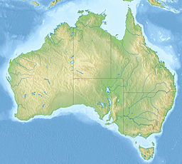
The sound covers an area of 110 square kilometres (42 sq mi) and varies in depth from 10 to 35 metres (33 to 115 ft).[5] Situated at its western shore is the city of Albany.[6] The sound is bordered by the mainland to the north, by Vancouver Peninsula on the west, and by Bald Head and Flinders Peninsula to the south. Although the sound is open water to the east, the waters are partially protected by Breaksea Island and Michaelmas Island. There are two harbours located within the sound, Princess Royal Harbour to the west and Oyster Harbour to the north. Each receives excellent protection from winds and heavy seas. Princess Royal Harbour was Western Australia's only deep-water port for around 70 years until the Fremantle Inner Harbour was opened in 1897.[7]
- ^ Dobson, John (3 July 2020). "Albany, WA's oldest colonial settlement, to officially adopt joint Noongar names". Australia: ABC News. Retrieved 9 July 2022.
King George Sound, known as Menang Koort to the Noongar people, meaning "heart of the whale".
- ^ "Restoring Menang Noongar Place Names - Central" (PDF). City of Albany.
- ^ "SHIP NEWS". The Sydney Gazette and New South Wales Advertiser. Vol. 3, no. 137. New South Wales. 13 October 1805. p. 2. Retrieved 9 July 2022 – via National Library of Australia.
- ^ "What Is the Right Name?". Perth WA: The West Australian. 29 October 1935. p. 15. Retrieved 31 August 2014.
- ^ "Albany Waterways Resource Book: King George Sound". 2000. Retrieved 9 November 2010.
- ^ "King George Sound". Gazetteer of Australia. Geoscience Australia. Archived from the original on 4 June 2011. Retrieved 18 February 2007.
- ^ "The Fremantle Harbour. The S.S. Sultan at the South Quay". The West Australian. 5 May 1897. p. 2. Retrieved 30 November 2013.


