This article needs additional citations for verification. (February 2013) |
Kingston | |
|---|---|
Rural settlement | |
 Kingston | |
 | |
| Coordinates: 45°20′S 168°43′E / 45.333°S 168.717°E | |
| Country | New Zealand |
| Region | Otago |
| Territorial authority | Queenstown-Lakes District |
| Ward | Queenstown-Wakatipu Ward |
| Electorates |
|
| Government | |
| • Territorial authority | Queenstown-Lakes District Council |
| • Regional council | Otago Regional Council |
| • Mayor of Queenstown-Lakes | Glyn Lewers |
| • Southland MP | Joseph Mooney |
| • Te Tai Tonga MP | Tākuta Ferris |
| Area | |
| • Total | 0.60 km2 (0.23 sq mi) |
| Population (June 2024)[2] | |
| • Total | 380 |
| • Density | 630/km2 (1,600/sq mi) |
| Time zone | UTC+12 (NZST) |
| • Summer (DST) | UTC+13 (NZDT) |
| Postcode | 9793 |
| Area code | 03 |
| Local iwi | Ngāi Tahu |
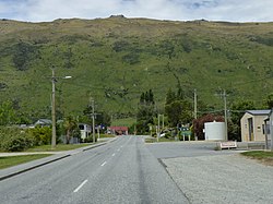
Kingston is a small town at the southernmost end of Lake Wakatipu, just north of the border of Otago and Southland, in New Zealand's South Island. It is 47 kilometres south of Queenstown by a road, "The Devil's Staircase", which winds between the lake to the west and The Remarkables mountains to the east. It is 70 kilometres north of Lumsden, and close to the headwaters of the Mataura River.
- ^ Cite error: The named reference
Areawas invoked but never defined (see the help page). - ^ "Aotearoa Data Explorer". Statistics New Zealand. Retrieved 26 October 2024.