Kingston Mines | |
|---|---|
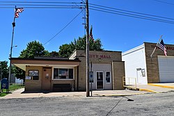
 Kingston Mines post office and city hall | |
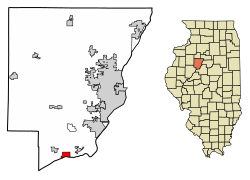
 Location of Kingston Mines in Peoria County, Illinois. | |
 Location of Illinois in the United States | |
| Coordinates: 40°33′29″N 89°46′19″W / 40.55806°N 89.77194°W | |
| Country | United States |
| State | Illinois |
| County | Peoria |
| Area | |
• Total | 1.58 sq mi (4.11 km2) |
| • Land | 1.44 sq mi (3.74 km2) |
| • Water | 0.14 sq mi (0.37 km2) |
| Population (2020) | |
• Total | 266 |
| • Density | 184.21/sq mi (71.11/km2) |
| Time zone | UTC-6 (CST) |
| • Summer (DST) | UTC-5 (CDT) |
| ZIP Code(s) | 61539 |
| Area code | 309 |
| FIPS code | 17-40091 |
| Wikimedia Commons | Kingston Mines, Illinois |
| Website | villageofkingstonmines |
Kingston Mines is a village in Peoria County, Illinois, United States. The population was 259 at the 2000 census. It is part of the Peoria, Illinois Metropolitan Statistical Area. Located on the Illinois River, it was a shipping port, loading coal from the nearby mines (the largest nearby mine was called Kingston).[2][3]
- ^ "2020 U.S. Gazetteer Files". United States Census Bureau. Retrieved March 15, 2022.
- ^ Leyland, Marilyn J. (April 2021). "A History Underground". Peoria Magazine.
- ^ Lynn, Greg (March 28, 2012). "A History Underground". Peoria Magazine. Retrieved October 13, 2023.