Kinnula | |
|---|---|
Municipality | |
| Kinnulan kunta Kinnula kommun | |
 Kinnula church | |
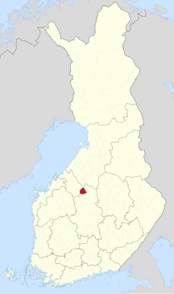
 Location of Kinnula in Finland | |
| Coordinates: 63°22′N 024°58′E / 63.367°N 24.967°E | |
| Country | |
| Region | Central Finland |
| Sub-region | Saarijärvi–Viitasaari sub-region |
| Government | |
| • Municipal manager | Kirsi Kellokangas |
| Area (2018-01-01)[1] | |
• Total | 495.71 km2 (191.39 sq mi) |
| • Land | 460.2 km2 (177.7 sq mi) |
| • Water | 35.48 km2 (13.70 sq mi) |
| • Rank | 190th largest in Finland |
| Population (2024-10-31)[2] | |
• Total | 1,505 |
| • Rank | 278th largest in Finland |
| • Density | 3.27/km2 (8.5/sq mi) |
| Population by native language | |
| • Finnish | 98.9% (official) |
| • Swedish | 0.1% |
| • Sami | 0.1% |
| • Others | 1% |
| Population by age | |
| • 0 to 14 | 17.4% |
| • 15 to 64 | 49.2% |
| • 65 or older | 33.4% |
| Time zone | UTC+02:00 (EET) |
| • Summer (DST) | UTC+03:00 (EEST) |
| Website | www.kinnula.fi |
Kinnula is a municipality of Finland.
It is located in the Central Finland region. The municipality has a population of 1,505 (31 October 2024)[2] and covers an area of 495.71 square kilometres (191.39 sq mi) of which 35.48 km2 (13.70 sq mi) is water.[1] The population density is 3.27 inhabitants per square kilometre (8.5/sq mi).
Neighbouring municipalities are Kivijärvi, Lestijärvi, Perho, Pihtipudas, Reisjärvi and Viitasaari.
The municipality is unilingually Finnish.
- ^ a b "Area of Finnish Municipalities 1.1.2018" (PDF). National Land Survey of Finland. Retrieved 30 January 2018.
- ^ a b c "Finland's preliminary population figure was 5,635,560 at the end of October 2024". Population structure. Statistics Finland. 19 November 2024. ISSN 1797-5395. Retrieved 22 November 2024.
- ^ "Population according to age (1-year) and sex by area and the regional division of each statistical reference year, 2003–2020". StatFin. Statistics Finland. Retrieved 2 May 2021.
- ^ a b "Luettelo kuntien ja seurakuntien tuloveroprosenteista vuonna 2023". Tax Administration of Finland. 14 November 2022. Retrieved 7 May 2023.
