Kippen
| |
|---|---|
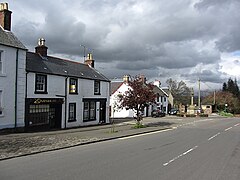
 Main Street, Kippen | |
Location within the Stirling council area | |
| Population | 1,100 (2022)[1] |
| OS grid reference | NS650948 |
| Civil parish |
|
| Council area | |
| Country | Scotland |
| Sovereign state | United Kingdom |
| Post town | Stirling |
| Postcode district | FK8 |
| Dialling code | 01786 |
| Police | Scotland |
| Fire | Scottish |
| Ambulance | Scottish |
| UK Parliament | |
| Scottish Parliament | |
Kippen is a village in west Stirlingshire, Scotland. It lies between the Gargunnock Hills and the Fintry Hills and overlooks the Carse of Forth to the north. The village is 9 miles (14 kilometres) west of Stirling and 20 mi (32 km) north of Glasgow. It is 4+1⁄2 mi (7 km) south-east of Loch Lomond and the Trossachs National Park, Scotland's first National Park.
The village lies on the line of an eighteenth-century military road between Stirling and Balloch, although a bypass around the village was built in 1971 meaning Kippen no longer lies on the A811. According to the 2001 census, the population of Kippen was 1,140.[2]
- ^ "Mid-2020 Population Estimates for Settlements and Localities in Scotland". National Records of Scotland. 31 March 2022. Retrieved 31 March 2022.
- ^ 2001 CENSUS RESULTS – KIPPEN COMMUNITY COUNCIL Archived 27 September 2007 at the Wayback Machine (pdf) Source: General Register Office for Scotland. Retrieved 5 January 2007.
