This article needs additional citations for verification. (June 2016) |
| Kirenga | |
|---|---|
 The Kirenga at Magistralny | |
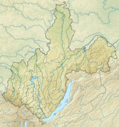
Mouth location in Irkutsk Oblast, Russia | |
| Location | |
| Country | Russia |
| Physical characteristics | |
| Source | Baikal Mountains |
| • elevation | ca 1,500 m (4,900 ft) |
| Mouth | Lena |
• coordinates | 57°46′08″N 108°07′48″E / 57.76889°N 108.13000°E |
• elevation | 250 m (820 ft) |
| Length | 746 km (464 mi) |
| Basin size | 46,600 km2 (18,000 sq mi) |
| Discharge | |
| • average | 658 m3/s (23,200 cu ft/s) |
| Basin features | |
| Progression | Lena→ Laptev Sea |
The Kirenga (Russian: Киренга) is a river in Irkutsk Oblast in Russia. The name originated in an Evenki word. The length of the river is 746 kilometres (464 mi). The area of its basin is 46,600 square kilometres (18,000 sq mi).[1]
There are many settlements in the river valley. The Baikal Amur Mainline follows and crosses the Kirenga between Magistralny and Ulkan.[2]
- ^ "Река Киренга (Лев. Киренга) in the State Water Register of Russia". textual.ru (in Russian).
- ^ Cite error: The named reference
WRwas invoked but never defined (see the help page).
