Kirkcudbrightshire | |
|---|---|
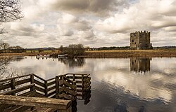
 Threave Castle, by the River Dee | |
 | |
| Country | Scotland |
| County town | Kirkcudbright |
| Area | |
• Total | 899 sq mi (2,328 km2) |
| Ranked 10th of 34 | |
| Chapman code | KKD |
Kirkcudbrightshire (/kɜːrˈkuːbriʃər/ kur-KOO-bree-shər) or the County of Kirkcudbright or the Stewartry of Kirkcudbright is one of the historic counties of Scotland, covering an area in the south-west of the country. Until 1975, Kirkcudbrightshire was an administrative county used for local government. Since 1975, the area has formed part of Dumfries and Galloway for local government purposes. Kirkcudbrightshire continues to be used as a registration county for land registration. A lower-tier district called Stewartry covered the majority of the historic county from 1975 to 1996. The area of Stewartry district is still used as a lieutenancy area. Dumfries and Galloway Council also has a Stewartry area committee.
Ultimately meaning "shire of the church of Saint Cuthbert", Kirkcudbrightshire forms the eastern part of the medieval lordship of Galloway, which retained a degree of autonomy until it was fully absorbed by Scotland in the 13th century. In 1369, the part of Galloway east of the River Cree was placed under the control of a steward based in Kirkcudbright and so that area became known as the "Stewartry of Kirkcudbright". The rest of Galloway remained under the authority of a sheriff based in Wigtown, and so became known as Wigtownshire. Kirkcudbrightshire was occasionally referred to as East Galloway.[1] It is bounded on the north by Ayrshire, on the west by Wigtownshire, on the south by the Irish Sea and Solway Firth, and on the east by Dumfriesshire. The county town is Kirkcudbright.
- ^ The New Statistical Account of Scotland (1834)
