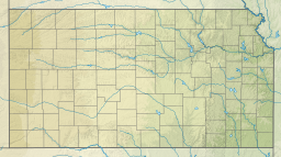
| Kirwin Reservoir | |
|---|---|
 Aerial view of Kirwin Reservoir | |
 | |
| Location | Phillips County, Kansas |
| Coordinates | 39°39′22″N 99°09′40″W / 39.65611°N 99.16111°W |
| Type | Reservoir |
| Primary inflows | North Fork Solomon River, Bow Creek |
| Primary outflows | North Fork Solomon River |
| Catchment area | 1,367 sq mi (3,540 km2) |
| Basin countries | United States |
| Managing agency | U.S. Bureau of Reclamation |
| Built | March 1952 |
| First flooded | October 1955 |
| Max. length | 9 miles (14 km) |
| Surface area | 5,079 acres (20.55 km2) |
| Max. depth | 49 feet (15 m)[1] |
| Water volume | Full: 98,154 acre⋅ft (121,071,000 m3)[2] Current (Nov. 2015): 34,199 acre⋅ft (42,184,000 m3)[3] |
| Shore length1 | 37 miles (60 km) |
| Surface elevation | Full: 1,729 ft (527 m)[2] Current (Nov. 2015): 1,713 ft (522 m)[3] |
| Settlements | Kirwin, Glade |
| References | [4] |
| 1 Shore length is not a well-defined measure. | |
Kirwin Reservoir is a reservoir in Phillips County, Kansas, United States.[4] It is located next to the city of Kirwin in northern Kansas. The U.S. Bureau of Reclamation built it and continues to operate it for the purposes of flood control and area irrigation. The Kirwin National Wildlife Refuge lies on its shores.[5]
- ^ "Kirwin Reservoir Fishing Information". Kansas Department of Wildlife, Parks and Tourism. Retrieved 2015-11-09.
- ^ a b "Kirwin Reservoir Allocations" (PDF). U.S. Bureau of Reclamation. 2012-10-16. Retrieved 2015-11-06.
- ^ a b Cite error: The named reference
Conditionswas invoked but never defined (see the help page). - ^ a b "Kirwin Reservoir". Geographic Names Information System. United States Geological Survey, United States Department of the Interior. Retrieved 2015-11-02.
- ^ Cite error: The named reference
Unitwas invoked but never defined (see the help page).

