Kitami
北見市 | |
|---|---|
 Clockwise from top: Kitami Mint Memorial Museum, ADVICS TOKORO CURLING HALL, Street in Onneyu area, Kitami BBQ Festival in February, NORTHERN ARC RESORT, Pierson Memorial Museum | |
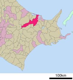
 Location of Kitami in Hokkaido (Okhotsk Subprefecture) | |
| Coordinates: 43°48′11″N 143°53′41″E / 43.80306°N 143.89472°E | |
| Country | Japan |
| Region | Hokkaido |
| Prefecture | Hokkaido (Okhotsk Subprefecture) |
| Government | |
| • Mayor | Naotaka Tsuji (from September 2015) |
| Area | |
| • Total | 1,427.41 km2 (551.13 sq mi) |
| Population (July 31, 2023) | |
| • Total | 112,185 |
| • Density | 79/km2 (200/sq mi) |
| Time zone | UTC+09:00 (JST) |
| City hall address | 1 Higashi Ni-chōme, Kita Go-jō, Kitami-shi, Hokkaido 090-8501 |
| Climate | Dfb |
| Website | www |
| Symbols | |
| Flower | Chrysanthemum |
| Tree | Japanese yew |

Kitami (北見市, Kitami-shi) is a city in Okhotsk Subprefecture, Hokkaido, Japan. It is the most populous city and the commercial center in the subprefecture, although the subprefecture capital is Abashiri.
Kitami is physically in the middle of Okhotsk Subprefecture. The Kitami Mountains are nearby and are the main reason behind the city's name. The city is the result of the merger of Kitami, Tanno, Tokoro and Rubeshibe towns in 2006 administrative reform. Kitami developed mainly in commerce and industry/service industries, Tanno in agriculture, Tokoro in fishery and agriculture, and Rubeshibe in forestry and tourism on hot springs.
Due to the characteristics of the region, Kitami has the highest onion and white flower bean production in Japan. Scallop fishing also flourishes, which makes it the "birthplace of scallop farming" in the country. In addition, the region is home to historical and tourist places like the Pearson Museum, Wakka Wild Flower Garden, and Tokoro Ruins, which are listed as "Hokkaido Heritage" sites.[1][2]
As of July 31, 2023, the city had a population of 112,185,[3] citizens in 61,793 households. The population density is 78.6 inhabitants per square kilometre (204/sq mi) . The total area is 1,427.41 km2 (551.13 sq mi).
- ^ "Kitami City information 2014" (PDF). June 29, 2015. Archived from the original (PDF) on June 29, 2015. Retrieved December 18, 2021.
- ^ "Hokkaido Heritage sites" (PDF).
- ^ "Official website of Kitami City" (in Japanese). Japan: Kitami City. Retrieved May 15, 2017.


