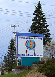
Kitigan Zibi | |
|---|---|
First Nations Reserve | |
 Welcome sign | |
| Coordinates: 46°20′N 75°58′W / 46.333°N 75.967°W | |
| Country | |
| Province | |
| Region | Outaouais |
| Established | 1851 |
| Government | |
| • Type | Band council |
| • Chief | Dylan Whiteduck |
| • Federal riding | Pontiac |
| • Prov. riding | Gatineau |
| Area | |
• Total | 210.09 km2 (81.12 sq mi) |
| • Land | 195.06 km2 (75.31 sq mi) |
| Population | |
• Total | 1,204 |
| • Density | 6.2/km2 (16/sq mi) |
| Time zone | UTC−05:00 (EST) |
| • Summer (DST) | UTC−04:00 (EDT) |
| Postal Code | J9E |
| Area code | 819 |
| Website | kitiganzibi |


Kitigan Zibi (also known as River Desert, and designated as Maniwaki 18 until 1994) is a First Nations reserve of the Kitigan Zibi Anishinabeg First Nation, an Algonquin band. It is situated near the confluence of the Désert and Gatineau Rivers, and borders south-west on the Town of Maniwaki in the Outaouais region of Quebec, Canada. Having a total area of 210.09 km2 (81.12 sq mi),[4] it is the largest Algonquin Nation in Canada in both area and population.[5]
Present on the reserve are shops, an elementary and secondary school, a community hall, a health centre, police services, a youth centre, a retirement home, a cultural centre, and the CKWE 103.9 radio station.[5][6]
- ^ First Nation details for the Kitigan Zibi Anishinabe First Nations at Indigenous and Northern Affairs Canada. Retrieved 2021-07-19.
- ^ Governance of the Kitigan Zibi Anishinabe First Nations at Indigenous and Northern Affairs Canada. Retrieved 2021-07-19.
- ^ a b "Kitigan Zibi, IRI, Quebec". Census Profile, 2021 Census. Statistics Canada. 2022-02-09. Retrieved 2022-03-17.
- ^ Reserve, settlement or village details for Kitigan Zibi Anishinabe Reserve at Indigenous and Northern Affairs Canada. Retrieved 2021-07-19.
- ^ a b "The Algonquin Communities: Kitigan Zibi Anishinabeg". Anishinabe Nation. Algonquin Anishinabeg Nation Tribal Council. 2016. Retrieved 2020-08-26.
- ^ "Health & Social Services". Kitigan Zibi Anishinabe. Kitigan Zibi Anishinabe. 2020. Retrieved 2020-08-27.
